Trekking Tours

Posted by Author On 5/29/2009

POST-SUMMARY-HERE

Everest, Everest History, Everest Firsts

Posted by Author On 5/29/2009

POST-SUMMARY-HERE

Expedition, expedition list, expeditions on 8000m peaks

Posted by Author On 5/29/2009

POST-SUMMARY-HERE

Showing posts with label trek. Show all posts

Cerro Aconcagua is the highest mountain in the Americas 6,962 metres (22,841 ft), and the highest mountain outside Asia. It is located in the Andes mountain range, in the Argentine province of Mendoza. The summit is located about 5 kilometres from San Juan Province and 15 kilometres from the international border with Chile. It lies 112 km (70 mi) west by north of the city of Mendoza. Aconcagua is the highest peak in both the Western and Southern Hemispheres. It is one of the Seven Summits.

Aconcagua is bounded by the Valle de las Vacas to the north and east and the Valle de los Horcones Inferior to the West and South. The mountain and its surroundings are part of the Aconcagua Provincial Park. The mountain has a number of glaciers. The most substantial are the north-eastern or Polish Glacier and the eastern or English Glacier.

The mountain was created by the subduction of the Nazca Plate beneath the South American plate during the geologically recent Andean orogeny; however, it is not a volcano.[2] The origin of the name is contested, it is either from the Arauca Aconca-Hue, which refers to the Aconcagua River and means 'comes from the other side' or the Quechua Ackon Cahuak, meaning 'Sentinel of Stone'.

Aconcagua with Patagonicas – Trip Description

ACONCAGUA POLISH GLACIER EXPEDITION

Route Description.

We will continue to approach the Polish Glacier via the Guanacos Valley and traverse the mountain. If you are signing up for the Polish Glacier Route you need to have previous high altitude experience, and be very familiar with the use of ice axe, crampons, and belaying techniques. We are specialized in the Polish Glacier Route, having successfully guided it many times.


Aconcagua Polish Glacier

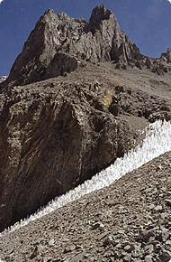
The line we choose will depend on conditions. If a lot of penitentes (snow pinnacles formed by direct sunlight) are encountered in the lower section of the glacier, we will start by climbing through the scree and rock on the right hand side.


Guanacos Valley

The steeper Polish Glacier Direct Route has been the choice route in recent years. Although steeper, it is safer and easier due to fewer icy and exposed traverses than on the old Polish Route. On this spectacular, steep snow and ice climb we will use several running belays.


Moving to High Camp 19,200

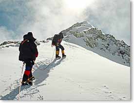
In steeper icy sections we will climb pitches instead of using running belays, belaying and regrouping at every anchor. A long day of climbing will take us to the Summit Ridge at 22,000' after the last steep pitch; a 55-60 degree narrow gully with the entire Glacier below at our feet. The final ridge is very long and gentle. After summiting, we descend quickly down the Normal Route to Independencia (20,790') where we descend to our High Camp at 19,200' to rest and spend the night. The next day we descend the Normal Route.

Polish Glacier Route Itinerary.

For a more detailed trip overview and itinerary , click here.
DAY 1: Group meets in Mendoza, Argentina. Equipment check and afternoon briefing at the hotel. For dinner we will have a chance to taste fine Argentinean cuisine and wine.
DAY 2: Drive West from Mendoza to Penitentes ski area at 8,500 . Our drive winds along the Rio Mendoza deep into the heart of the rugged Andes mountains where we begin our acclimatization in Penitentes. An afternoon hike is recommended, though optional.
DAY 3-4-5: Approach to Plaza Guanacos Base Camp. Mules carry our gear. This approximately 35 mile approach is essential to our acclimatization. Our first two days we follow the same route as Aventuras Patagonicas old Traverse and Polish Glacier Expeditions. The third day begins our new approach. We continue up the Vacas Valleyinstead of ascending the Relinchos Valley. The chances of seeing other expeditions on this new exciting route is remote. The chance of seeing numerous wildlife is much moreprobable. Spectacular glaciers contrasting with a desert backdrop make this approach both surreal and unforgettable. We have an excellent chance of seeing herds of guanacos. When Rodrigo did an exploratory trip to the region he encountered several hundred, counting 80 in one sighting alone! These magnificent mammals are well camouflaged, extremely elusive and a rare sight in the Aconcagua region.
DAY 6: Plaza Guanaco Base Camp at 13,000 . Rest and acclimatization day at Base Camp. We want everyone to have the best possible chance to make the summit. The most effective way to do this is to take the time to acclimatize to the low oxygen environment. We will incorporate rest days into our schedule and climb in traditional expedition style. We will be carrying loads up to the next camp and returning to sleep below at the previous camp. The next day we will move to the higher camp environment.
DAY 7: Carry a load to Camp I at approximately 15,200. The route goes up the narrow valley between the North side of Cerro Ameghino and Cerro San Francisco. Here we will be able to see Nieve Penitentes, unique snow and ice formations created by the direct sun. Return to Base Camp.
DAY 8: Leave Base Camp. Move to Camp I.
DAY 9: Carry a load to Camp II at 16,500 . Fantastic view of the Polish Glacier. We ascend scree slopes to a broad ridge crest where we will establish Camp II.
DAY 10: Move to Camp II.
DAY 11: Carry a load to Camp III, below the Polish Glacier at 17,800 .
DAY 12: Move to Camp III. depending on how group is doing.
DAY 13: Carry a load to High Camp, at 19,200 . We will establish this camp at the base of the Polish Glacier.
DAY 14: Move to High Camp.
DAY 15-17: Summit! Weather permitting. We allow several days for our Summit Day in case of poor weather.
DAY 18: Descend the Normal Route to Plaza de Mulas Base Camp. This will be quite exciting since we will be descending a different side of the mountain.
DAY 19: Hike out the Horcones Valley, with its impressive views of Aconcagua s South Face. Spend the night in Penitentes.
DAY 20: Drive to Mendoza. Enjoy delicious team banquet! Next day fly home or continue traveling in South America.

Note: This itinerary is intended to be a guideline only, weather days and rest days are always a possibility while on a climbing expedition.

For a more detailed : - http://patagonicas.com/index.html

.. more : 1 - http://www.andesmountain.cl/indexaco_ing.htm

2 - http://www.aconcagua-express.com/

3 - http://www.aconcaguaexpeditions.com/

*Previous story : - Seven Summits.

Aconcagua with Patagonia - Agencja górska.


Aconcagua - wyprawa z Ryszardem Pawłowskim.

Ryszard Pawłowski - światowej sławy himalaista, zaprasza na wyprawy by zdobywać wspaniałe szczyty na wszystkich kontynentach.

..jego sylwetka na : - Ryszard Pawłowski the famous Polish climber. /Version english and polish/

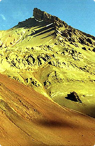
W najrozleglejszych górach świata, Andach, położony jest najwyższy szczyt obu Ameryk i zarazem najwyższy szczyt wznoszący się poza Azją - Aconcaqua.
Góra nazwana przez Inków Acconcahuac (co w ich języku oznacza "kamienny straznik") stanowi jeden z filarów "Korony Ziemi" co czyni ją szczególnie atrakcyjną dla wspinaczy.

Aconcaqua leży w argentyńskiej prowincji Mendoza, 15 km od granicy z Chile. Jest masywem pochodzenia wulkanicznego, swoja wysokością znacznie przewyższa sąsiednie wierzchołki, wydając się jeszcze wyższa niż jest w istocie.
Otaczające ja góry pokryte są jałowymi, stromymi zboczami , stanowiącymi pustynny teren z usuwającymi się spod nóg kamieniami. Roślinność jest tu bardzo uboga i praktycznie zanika na wysokości ok. 4000 m co potęguje wrażenie pustki i surowości i sprawia że rejon ten odwiedzany jest niemal wyłącznie przez wojskowych i wspinaczy.
Szczególne wrażenie robi pionowa, południowa ściana widziana z doliny Horcones - ścianą tą, wśród barier seraków i ruchomych skał, prowadzą najtrudniejsze drogi na wierzchołek.
Lista sprzętu do zabrania na wyprawę:


  1. śpiwór puchowy
  2. kurtka puchowa
  3. botki puchowe
  4. wór transportowy (80-100 L)
  5. plecak (60-80 L)
  6. plecak mały (20-30 L) - podręczny
  7. buty plastikowe
  8. buty trekkingowe
  9. rękawice ciepłe (łapa wice)
  10. rękawiczki polar albo wind stopper
  11. rękawiczki cienkie (od słońca)
  12. bluza z polara (lub wind stopper)
  13. spodnie z polara
  14. bluza przeciwwiatrowa
  15. spodnie przeciwwiatrowe
  16. termos
  17. butelka na napoje
  18. raki
  19. kijki narciarskie
  20. czapka ciepła
  21. czapka przeciwsłoneczna z daszkiem i osłoną na kark
  22. okulary przeciwsłoneczne (lodowcowe)
  23. ochraniacze przeciwśniegowe
  24. bielizna przeciwpotliwa (koszulki-2 szt., kalesony 2-szt.)
  25. koszulki bawełniane
  26. gogle narciarskie
  27. termorest lub karrimat - 2 szt.
  28. krem oraz pomadka z filtrem UV
  29. przybory kuchenne osobiste (kubek, łyżka, miska)
  30. czołówka i zapasowe baterie
  31. aparat fotograficzny
  32. ulubiona maskotka

Pamiętaj, nawet najlepszy sprzęt nie zapewni Ci wejścia na szczyt
bez przygotowania kondycyjnego i nastawienia psychicznego!

Kalendarium. aconcagua-map_220.jpg

1897 - szwajcarski przewodnik M. Zurbriggen, członek brytyjskiej ekspedycji pod kierownictwem E. Fitzgeralda, zdobywa szczyt 14 stycznia wchodząc od strony zachodniej, drogą uznawaną dzisiaj za klasyczną
1934 - czworka polskich wspinaczy: K. Narkiewicz-Jodko, S. Daszyński, W. Ostrowski i S. Osiecki dokonują pierwszego wejscia od strony wschodniej przez lodowiec, zwany odtąd Lodowcem Polaków
1954 - uczestnicy francuskiej wyprawy G.Poulet, R.Paragot, E.Denis, P. Lasueur, L. Bernardini i A.Dagory jako pierwsi pokonują trudny centralny filar na scianie południowej osiagając wierzchołek 28 lutego
1974 - austriacko-włoska wyprawa Reinholda Messnera dokonuje prostowania w górnym odcinku drogi francuskiej z 1954. Siedemnaście lat póżniej, ta samą drogę pokonuje samotnie Austriak T. Bubendorfer
1982 - czterej Słoweńcy Z. Gantar, I. Rejc oraz bracia Pavel i Peter Podgornik po dziewięciodniowej wspinaczce na południowej ścianie osiągają południowy wierzchołek góry. Obecnie droga ta, nazwana "słoweńską", uznawana jest za najtrudniejszą na całej górze.

Krótka informacja o wyprawie:
Celem wyprawy jest wejście na szczyt Aconcaqua - najwyższy szczyt obu Ameryk.
Wybieramy jeden z dwóch klasycznych wariantów osiągnięcia wierzchołka tzn. od północnego wschodu, rozpoczynając z miejscowości Punta del Inca. Po trzech dniach marszu przez doliny Vacas i Relinchos docieramy do bazy Plaza Argentina, ulokowanej na wysokości 4200 m. Do tego miejsca bagaż transportowany jest na grzbietach mułów; powyżej bazy cały niezbędny sprzęt transportują uczestnicy, przy okazji zdobywając aklimatyzację i kondycję.

Przez następne parę dni zakładamy kolejne obozy: obóz I na wysokości ok. 5300 m oraz obóz II na wysokości ok. 5950 m. Przy dobrych warunkach pogodowych wejście na szczyt z obozu II zajmuje ok. 8-10 godzin, czas wejścia uzależniony jest przede wszystkim od (oprócz pogody) samopoczucia uczestników.

Program akcji górskiej jest tak ułożony, aby w razie nieudanego wejścia na szczyt np. ze względu na złą pogodę lub gorsze samopoczucie, możliwe było ponowienie ataku.

Do bazy wracamy tą samą trasą, likwidując po drodze kolejne obozy.
Warunki pogodowe jakie napotkamy podczas wyprawy są ekstremalne i skrajnie różne - od zenitalnego słońca na początku podejścia do ujemnych temperatur, lodu, sniegu i silnych wiatrów w wyższych partiach góry.
Samo wejście na Aconcaque nie stwarza większych trudności technicznych, pamiętać jednak należy, że znaczna wysokość (prawie 7000 m) oraz często występujące trudne warunki pogodowe sprawiają, że wejście na wierzchołek jest zawsze poważnym przedsięwzięciem.

*Previous story : - Seven Summits.

- oryginal post by : - http://himalman.wordpress.com/

goryonline.com

* zapraszam do subskrypcji mojego bloga :

AddThis Feed Button

** zapraszam na relacje z wypraw polskich himalaistów.

Climb Mt. Vinson - highest peak in Antarctica.

Posted by himalman On 7/03/2009 09:22:00 am 0 comments


Climb Mt. Vinson with Berg Adventures – Trip Description

Explore the Ellsworth Mountains of Antarctica.

This is the big one. A trip to the interior of Antarctica with Berg Adventures is a lifetime adventure for any explorer. We all seek adventure and beauty to enrich our lives. Climber on VinsionThe unspeakable grandness and sublime space of Antarctica is unmatched and will leave you forever with the satisfaction of knowing that you have at least glimpsed the pure, empty soul of our planet.

Mount Vinson, the highest peak in Antarctica, was first climbed in 1966 by Americans John Evans, Barry Corbet, Pete Schoening and William Long. In 1983 Dick Bass and Frank Wells climbed Mt. Vinson during their famous Seven Summits quest. Their pilot was a skilled young British aviator named Giles Kershaw. In 1984 and 1985 Kershaw returned to Antarctica with Canadian climbers Martyn Williams and Pat Morrow. Their team of 8, including Kershaw himself reached the summit of Vinson on November 19th.

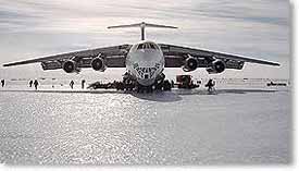
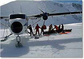
It was during the 80’s that Giles Kershaw, British glaciologists Charles Swithinbank and Mike Maxwell identified the “blue ice runway” at Patriot Hills, the natural feature that spawned the growth of an Antarctic Base. When we leave Punta Arenas Chile on our flight across the Drake Passage for Antarctica, the Blue Ice Runway and Patriot Hills will be our goal. After a brief taste of life in a “real” Antarctic Base, we will venture out in smaller ski-equipped aircraft for the Ellsworth Mountains.

Climbing Mt. Vinson with Berg Adventures involves establishing three camps above our base camp at 8,000 ft on the Branscomb Glacier. Climbing is moderate snow climbing, with slope angles up to 45 degrees. Temperatures are cold, below 0 degrees F for the entire trip. But without the temperature fluctuations that one experiences in other glacier ranges of the world dressing for these temperatures and moving in them is surprisingly easy. In direct sunlight you can be quite warm. Although it is light for 24 hours in the austral polar regions at this time of year, the sun will go behind ridges in the Ellsworth Mountains for a few hours each day. These are hours that we plan to be snug in our tents, resting for the next day’s climb. Antarctica is extremely dry. We do not use skis or snowshoes for travel between camps on Vinson. Crampons are worn on the moderately steep slopes of the upper mountain.
Internet Broadcast.

Your adventure in Antarctica will be cybercast to the Internet via satellite phone. Daily dispatches will be posted on the Web at BergAdventures.com. This will be a great way for your group to share stories and photographs of your adventures while “on the scene” during the climb. In the past, our dispatches have been used by family, friends and supporters to track the progress of our groups, by classrooms to learn about the wild places we visit, and by local newspapers to report stories of interest.

View our previous Mt. Vinson expedition dispatches.
Guides.

Past BAI Vinson climbs have been led by Wally Berg or Dave Hahn. Wally has guided three ascents of Mt. Vinson in previous years and was leader of the Omega Embree Glacier Expedition in 2000. This expedition explored the unvisited reaches of the upper Embree Glacier in the Ellsworth Mountains and Wally established a new route on the unclimbed west side of Mt. Bentley. Dave Hahn is the world’s premier Antarctica mountaineering guide. He has guided 23 ascents to the summit of Mt. Vinson, yet his love for the beauty and challenge of the mountain has not diminished.
Qualifications.

To climb Vinson you need to be in excellent physical condition. This is a glacier climb of easy to moderate difficulty. You should have some experience walking with an ice axe, using crampons and doing self-arrest. Most of the terrain is low angle, but summit day is long and has one 50 degree slope. Antarctica is extreme, but it is a surprisingly pleasant place to camp and live during the light weeks of the high Austral summer when we are there. Because temperature fluctuations are not great, it is easy to dress for the cold, sunny days. You need to have winter camping experience before you go in order to know how to manage your gear and body temperature. Selection of the proper equipment for climbing and camping in Antarctica is imperative. The continent is an uncompromising, vast and wonderful place.

* more : - http://www.bergadventures.com/

**Previous story : - Seven Summits.

- oryginal post by : - http://himalman.wordpress.com/

goryonline.com

* zapraszam do subskrypcji mojego bloga :

AddThis Feed Button

** zapraszam na relacje z wypraw polskich himalaistów.

Everest Trek 2009 - new video.

Posted by himalman On 6/30/2009 08:25:00 am 0 comments
I would like to invite you to watch one of movie of Everest collection…
Everest Trek 2009 - new video by Chris Marquardt.

A week in Kathmandu and two weeks of trekking to Mt. Everest Base Camp. Not only the worlds highest photo workshop, but a truly life-changing event for all the participants. Get a first taste of what to expect over the next months.


* Source : – http://www.youtube.com/

** Previous story : - VIDEOS.

* zapraszam do subskrypcji mojego bloga :

AddThis Feed Button

** zapraszam na relacje z wypraw polskich himalaistów.

JAPAN.

Posted by himalman On 6/20/2009 06:58:00 am 0 comments
1.

2.

CARIBBEN.

Posted by himalman On 6/20/2009 06:57:00 am 0 comments
1.

2.

CANADA.

Posted by himalman On 6/20/2009 06:56:00 am 0 comments
1.

2.

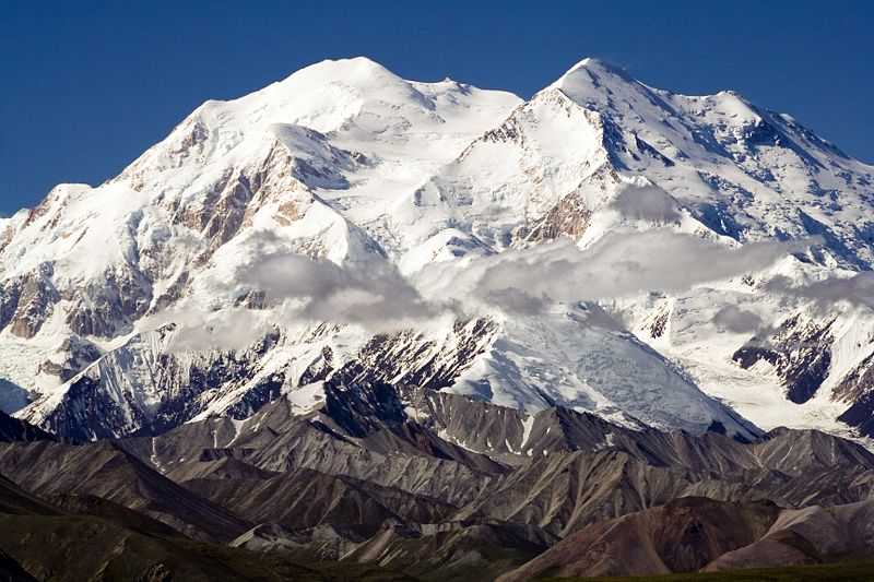
Mount McKinley or Denali in Alaska is the highest mountain peak in North America, at a height of approximately 20,320 feet (6,194 m).[1] It is the centerpiece of Denali National Park.

Mount McKinley or Denalione of Seven Summits list.

Notable features :

Mount McKinley has a larger bulk and rise than Mount Everest. Even though the summit of Everest is about 9,000 feet (2,700 m) higher as measured from sea level, its base sits on the Tibetan Plateau at about 17,000 feet (5,200 m), giving it a real vertical rise of little more than 12,000 feet (3,700 m). The base of Mount McKinley is roughly a 2,000-foot plateau, giving it an actual rise of 18,000 feet (5,500 m).

The mountain is also characterized by extremely cold weather. A thermometer left exposed at an elevation of 15,000 feet on Mount McKinley over 19 years recorded a temperature of −100°F (−73.3°C) at some point during its exposure[citation needed]. There is also an unusually severe risk of altitude illness for climbers, due to not only its high elevation but also its high latitude.[2] At the equator, a mountain as high as Mount McKinley would have 47% as much oxygen available on its summit as there is at sea level,[3] but because of its latitude, the pressure on the summit of McKinley is even lower.[4]

Climbing history :

The first recorded attempt to climb Mount McKinley was by Judge James Wickersham in 1903, via the Peters
Glacier and the North Face, now known as the Wickersham Wall. This route has tremendous avalanche danger and was not successfully climbed until 1963.

Famed explorer Dr. Frederick Cook claimed the first ascent of the mountain in 1906. His claim was regarded with some suspicion from the start, but was also widely believed. It was later proved fraudulent, with some crucial evidence provided by Bradford Washburn when he was sketched on a lower peak.

In 1910, four locals (Tom Lloyd, Peter Anderson, Billy Taylor, and Charles McGonagall), known as the Sourdough expedition, attempted McKinley, despite a complete lack of climbing experience. They spent approximately three months on the mountain. However, their purported summit day was impressive: carrying a bag of doughnuts, a thermos of cocoa each and a 14-foot (4.2 m) spruce pole, two of them reached the North Summit, lower of the two, and erected the pole near the top. According to them, they took a total of 18 hours — a record that has yet to be breached (as of 2006). No one believed their success (partly due to false claims that they had cd climbed both summits) until the true first ascent, in 1913. In 1912, the Parker-Browne expedition nearly reached the summit, turning back within just a few hundred yards of it due to harsh weather. In fact, that probably saved their lives, as a powerful earthquake shattered the glacier they ascended hours after they safely left it.

The first ascent of the main summit of McKinley came on June 7, 1913 by a party led by Hudson Stuck. The first man to reach the summit was Walter Harper, an Alaska Native. Harry Karstens and Robert Tatum also made the summit. Tatum later commented, “The view from the top of Mount McKinley is like looking out the windows of Heaven!”[5] They ascended the Muldrow Glacier route pioneered by the earlier expeditions, which is still often climbed today. Stuck confirmed, via binoculars, the presence of a large pole near the North Summit; this report confirmed the Sourdough ascent, and today it is widely believed that the Sourdoughs did succeed on the North Summit. However, the pole was never seen before or since, so there is still some doubt. Stuck also discovered that the Parker-Browne party were only about 200 feet (61 m) of elevation short of the true summit when they turned back.The peak from the north during sunrise

See the timeline below for more important events in Mount McKinley’s climbing history.

The mountain is regularly climbed today, with just over 50% of the expeditions successful, although it is still a dangerous undertaking. By 2003, the mountain had claimed the lives of nearly 100 mountaineers.[6] The vast majority of climbers use the West Buttress Route, pioneered in 1951 by Bradford Washburn, after an extensive aerial photographic analysis of the mountain. Climbers typically take two to four weeks to ascend the mountain.

Timeline :

  • 1896-1902 Surveys by Robert Muldrow, George Eldridge, Alfred Brooks.
  • 1903. First attempt, by Judge James Wickersham.
  • 1906. Frederick Cook falsely claims the first ascent of McKinley.
  • 1910. The Sourdoughs ascend the North Summit.
  • 1912. The Parker-Browne attempt almost reaches the South Summit.
  • 1913. First ascent by Hudson Stuck, Walter Harper, Harry Karstens, Robert Tatum.
  • 1932. Second ascent, by Alfred Linley, Harry Liek, Grant Pearson, Erling Strom. (Both peaks were climbed.)
  • 1947. Barbara Washburn becomes the first woman to reach the summit as her husband Bradford Washburn becomes the first to summit twice.
  • 1951. First ascent of the West Buttress Route, led by Bradford Washburn.
  • 1954. First ascent of the very long South Buttress Route.
  • 1959. First ascent of the West Rib, now a popular, mildly technical route to the summit.
  • 1961. First ascent of the Cassin Ridge, the best-known technical route on the mountain. This was a major landmark in Alaskan climbing.
  • 1963. Two teams make first ascents of two different routes on the Wickersham Wall.
  • 1967. First winter ascent, via the West Buttress, by Dave Johnston, Art Davidson, and Ray Genet.
  • 1967. Seven members of Joe Wilcox’s twelve-man expedition perish in a storm near the summit. Up to this time, this was the third worst disaster in mountaineering history in terms of lives lost.
  • 1970. First solo ascent by Naomi Uemura.
  • 1984. Uemura returns to make the first winter solo ascent, but dies after summitting. Tono Križo, František Korl and Blažej Adam from the Slovak Mountaineering Association climb a very direct route to the summit, now known as the Slovak Route, on the south face of the mountain, to the right of the Cassin Ridge.[7]
  • 1988. First solo winter ascent with safe return, by Vern Tejas.
  • 1990. Alaskan Norma Jean Saunders became the first woman to officially document a solo ascent of Mount McKinley. She climbed the West Buttress.

Mt. McKinley in July 2006

McKinley, Mount McKinley, Mount Denali (6194 m n.p.m.) – najwyższy szczyt Ameryki Północnej, położony w górach Alaska (USA). McKinley zbudowany jest ze skał krystalicznych (głównie granitów i łupków krystalicznych). Jego masyw pokryty jest wiecznym śniegiem i lodowcami, największy z nich, o długości ok. 50 km to lodowiec Muldrow. Względem otaczających go dolin występuje u jego stoków jedna z największych deniwelacji na świecie – ponad 5 kilometrów.

Po raz pierwszy szczyt został zdobyty w 1913. Nazwa na cześć amerykańskiego prezydenta Williama McKinleya, “Denali” to tradycyjna indiańska nazwa góry. Obecnie masyw McKinleya objęty jest parkiem narodowym Denali. Z uwagi na fakt, że jest to najwyższy szczyt Ameryki Północnej, wchodzi on w skład tzw. Korony Ziemi.

- oryginal post by : - http://himalman.wordpress.com/

goryonline.com

* zapraszam do subskrypcji mojego bloga :

AddThis Feed Button

** zapraszam na relacje z wypraw polskich himalaistów.

I Recommend….

http://www.nepalvisitors.com/

Nepal travel and trekking information. Includes, tour, tourism, trek, hiking, expedition, peak climbing, adventure holidays trips in Nepal.

nepalvisitors.com Mustang-Trek _600

Mustang has a long, rich and complex history that masks it one of the most interesting place in Nepal. The early history of Lo is Surrounded in legend. Myth and mystery, But there are records of events in Lo as early as the 8th century. It is quite likely that the Tibetan poet Milarepa, who lived from 1040 to 1123, visited Lo. Upper Mustang was once part of Ngari, a name for far western Tibet. Ngari was not a true political entity, but rather a loose collection of feudal domains that also included parts of Dolpo. By the 14th Century, much of Ngari, as well as most of what today is western Nepal, was part of the Malla empire governed from the capital at Sinja, near Jumla. It is generally believed that Ame Pal (Ama-dpal in Tibetan ) founded Lo in 1380 and was its first king. The Ancestry of the present Mustang Raja can be traced 25 generations back to Ame Pal. Ame Pal, or perhaps his father, conquered a large part of the territory in the upper Kali Gandaki and was responsible for the development of the city of Lo Manthang and many gompas. To the west, the Malla empire declined and split into numerous petty hill states. By the 18th century, Jumla had consolidated and reasserted its power. In an effort to develop their domain as a trading centre and to obtain Tibetan goods, the rulers of Jumla turned their attention eastward. In the mid-18th century they assumed control over Lo, from which they extracted as annual tribute. When he ascended the throne in 1762, prithvi Narayan Shah began to consolidated what is present-day nepal. At the time of his death, the kingdom extended from Gorkha eastward to the borders of Sikkim. His descendants directed their efforts westward and by 1789, Jumla had been annexed. The Gorkha armies never actually entered Lo; they recognized the rule of the Mustang Raja. Although Mustang became par of Nepal, the raja retained his title and Lo retained a certain amount of autonomy. Lo maintained its status as a separate principality until 1951. After the Rana rulers were overthrown and king Tribhuvan reestablished the rule of the Shah monarchs on 15 February 1951, Lo was more closely consolidated into Nepal. The raja was given the honorary rank of colonel in the Nepal army.

mustang-trek-b

Mustang Trek

During the 1960s, after the Dalai lama had fled to India and Chiness armies established control over Tibet, Mustang was a centre for guerrilla operations against the Chinese. The soldiers were the Khampas, Tibet’s most fearsome warriors, who were backed by the CIA (some Khampas were secretly trained in the USA). At the height of the fighting there were at least 6000khampas in Mustang and neighboring border areas. The CIA’s support ended in the early 1970s when the USA, under Kissinger and Nixon, Initiated new and Better relations with the Chinese. The government of Nepal was pressed to take action against the guerrillas and, making use of internal divisions within the Khampa leadership, a bit of treachery and the Dalai Lama’s taped advice for his citizens to lay down their arms, it managed to disband the resistance without committing to action the 10,000 Nepali troops that had been sent to the area.

mustang_trek

Mustang Trek

Though Mustang was closed, the vovernment allowed a few researchers into the area.Toni hagen included Mustang in his survey of the entire kindom of Nepal, and the Italian scholar Giuseppe Tucci visited in the autumn of 1952. Professor David Snellgrove travelled to the gegion in 1956 but did not visit Lo Manthang. Longtime Nepal resident Barbara Adams travelled to Mustang during the autumn of 1963.The most complete description of the area is Mustang, the Forbidden Kingdom, written by Michel Peissel, who spent several months in the area in the spring of 1964, Dr Harka Bahadur Gurung also visited and wrote about upper Mustang in October 1973. A number of groups legally travelled to upper Mustang during the 1980s by obtaining permission to climb Bhrikuti (6364), south-east of Lo Manthang.Other than a few special royal guests, the first legal trekkers were allowed into Mustang in March 1992 upon payment of a high fee for a special trekking permit.

Only camping trek allowed:
Completely closed to foreign trekkers until 1991, Mustang is an ancient Himalayan Kingdom. Inside the walled city of Lo Manthang are some of the largest Tibetan Buddhist gompas in Nepal. A difficult trek because of high altitude, exposed terrain and continual Strong winds.

Trip Facts:
Trekking Destination : Mustang Trek
Minimum altitude : 2810m.
Maximum altitude : 4,100m. (Ghar Gumba)
Grade :
Season : Spring & Autumn
Accommodation : Tented Camp
Duration : 17 Days
Minimum group size: 2 pax
Cost:$2050

Suggested Itinerary :
Day 01: Arrive Kathmandu & Transfer to Hotel.
Day 02: Full day guided sightseeing around of the Kathmandu valley. Join us for the welcome dinner at evening.
Day 03: Fly to Pokhara. Free to explore its attractions.
Day 04: Fly to Jomsom (2,700m), trek to Kagbeni (2,800m) (4 hrs) Camp
Day 05: Trek Kagbeni to Chhukasang (3,060m) (5-6 hrs). Camp.
Day 06: Trek Chhukasang to Samar (3,570m) (7-8 hrs). Camp.
Day 07: Trek Samar to Dhakmar (3,560m) (6-7 hrs). Camp.
Day 08: Trek Dhakmar to Tsarang (3,840m) (4-5 hrs). Camp.
Day 09: Trek Tsarang to Lo-Manthang (3,840m). Camp.
Day 10: Trek Lo-Manthang (Visit Eastern and Western Valley )
Day 11: Trek Lo-Manthang to Yara. (6 hrs). Camp.
Day 12: Trek Yara to Tangy (2,600m) (8 hrs). Camp.
Day 13: Trek Tangy to Tetang (2,600m). Camp.
Day 14: Trek Tetang to Muktinath (3,600m) (5 hrs). Camp.
Day 15: Trek Muktinath To Jomsom (2700m)(4 hrs). Camp.
Day 16: Flight Jomsom – Pokhara – Kathmandu.
Day 17: Free day to explore, and enjoy Kathmandu.
Day 18: Final Departure.

Copyright Contain By:
Nepal Visitors Network
P.O. Box :19760, Thamel, Kathmandu, Nepal.
Tel :+977-1-4263133, Fax:+977-1-4216454, +9779841258665 (M)
Skype: nepalvisitors
info@nepalvisitors.com

* Source :- http://himalman.wordpress.com/http://www.nepalvisitors.com/

goryonline.com

** zapraszam na relacje z wypraw polskich himalaistów.

Tibet Treks and Tours : Tour in Central Tibet.

Posted by himalman On 6/02/2009 07:50:00 am 0 comments

I Recommend….

http://www.nepal-guide.com/

alpine _Tibet _600

Tibet travel and trekking information. Includes, tour, tourism, trek, hiking, expedition, peak climbing, adventure holidays trips in Tibet

Tibet - Roof of the World.

Tibet (Xizang), the Roof of the World, remained unknown to the world until the beginning of the 20th tibet Potalacentury. The massive, snowy land has exerted an awesome draw on travelers and adventurers ever since. Its majestic scenery, mysterious and exotic religious culture, and wonderful people, reward every tourist with an indelible life long memory!

Tibet (Tibet Autonomous Region) borders Xinjiang, Qinghai, Sichuan and Yunnan internally while India, Burma, Bhutan, Sikkim, and Nepal meet its external borders. It covers a massive 1,220,000 square kilometers, which is about 12.8 % of the whole of China. With an average height of 4,000 meters above sea level, Tibet is encompassed by some of the world's highest mountains. The Himalayas to the south, the Karakoram to the west, and the Kunlun to the north are the dream lands of all adventurers and mountaineers.

The vast land is also the cradle of several great rivers such as the Yangtze River, the Yellow River, the Nu River (Salween), the Lancang River (Mekong), the Brahmaputra (Yarlong Tsangp), the Indus, and the Ganges. Tibet also offers awe-inspiring scenery of beautiful lakes and valleys. Over 1,500 lakes including Heavenly Namtso Lake, Dharma Lake and the holy Lake Manasarovar make Tibet the plateau with largest amount of lakes. Without irrigation and nurturance of these rivers and lakes, the surrounding lands may not flourish.

If you are interested to explore Tibet please let us know your holiday plan schedule or select your own program to make it on your Holiday period then we propose you best quotation and we let you know the possibility.

The Tibet tours program itinerary that we will create short and long within your demands and service that we offers deluxe, standard or budget. Please let's to know your estimate budget that we can make it enough.

Tour in Central Tibet.

* Source : – http://www.nepal-guide.com/tibet.htm


goryonline.com


** zapraszam na relacje z wypraw polskich himalaistów.

Sociofluid

Promote cool website

Climbing courses and training - PZA Climbing Center in Tatras
One of best website about Mt Everest
www.Everest1953.co.uk
You can help

Trekking agency

advertise on blog

MY Favorite books...


    Polish Himalayas on Facebook

    Great tops for everyone!

    Mountaineering is my hobby and profession of walking, hiking, trekking and climbing up mountains. It is also sometimes known as alpinism, particularly in Europe.

    Picasa Web Albums

    Himalman's Weblog